|
Ecuador, Volcan El Reventador
M. Rietze, Th. Boeckel (29th of Dec to 1rst January.2006) |
|
Ecuador, Volcan El Reventador
M. Rietze, Th. Boeckel (29th of Dec to 1rst January.2006) |
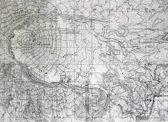
El Reventador (0° 04 ' 05' ' S / 77°40 ' 22 '' W) ranks as one of the most mysterious and hidden volcanos of South America. Placed in the Cayambe Coca area 90 kilometres northeast from Quito the volcano belongs to the area Amazonica. The active cone (former height of 3485-East, 3562-West, base diameter 2 km) is surrounded by an old Caldera, which has an impressive diameter of may 6 kilometres (map). In June 2005 the volcano had an enormous eruption, whereby the main cone blew itself up and the summit was reduced around 100 altimeters. According to informations of the volcanologist Bernardo Beate, the eruption cloud covered the 90 km distanced capital city Quito with a 2 cm ash layer. Powerful lava streams approached 3.5 kilometres to the oil pipeline, which provides the main oil system of the country.
Also we were interested which consequences this outbreak had, and made ourselves on the way into the unknown.
To get more or less useful background informations about this area was very difficult, and therefore it was a jump in the cold water or may into the warm jungle mud. As a consequence of proceeding conflicts with the borderland Colombia it was hard to visit this volcano the last years at all. Chris Weber was rejected approximately 10 years before by militia troops. An unclear situation was, whether people are residing at the starting point of the path, or settlements are existing along the main highway. This becomes an important criterion to provide yourself with plenty of food and drinking water if you make this trip on your own account.
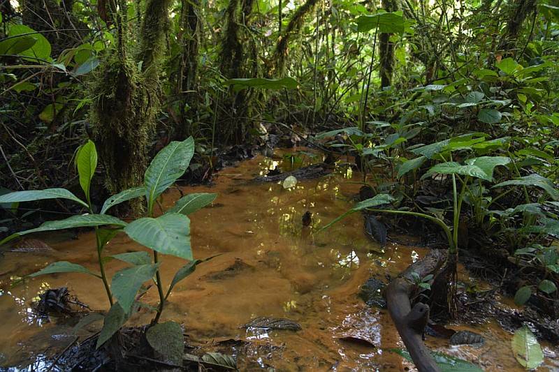
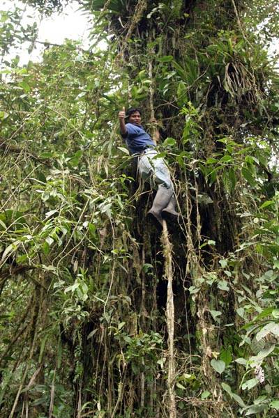
The next big question was, if continuous rainfalls can make the crossing of the primary jungle at the base of the Reventador into an impossible slippery. In the rain times it is nearly impossible to explore the deep jungle anyway. We ourselves made the experience several times with long continuing and very strong rainfalls despite the dry season. Nevertheless the muddy way was well passable. Picture left above: So much to our first guide (mourning!). The second local guide showed us by using lianas a more successful movement technology. Now well, here a guide is indispensable and you should invest the 30 $ for the jungle crossing simply for not getting lost in this labyrinth of smaller mountain ribs and aquiferous ravines.
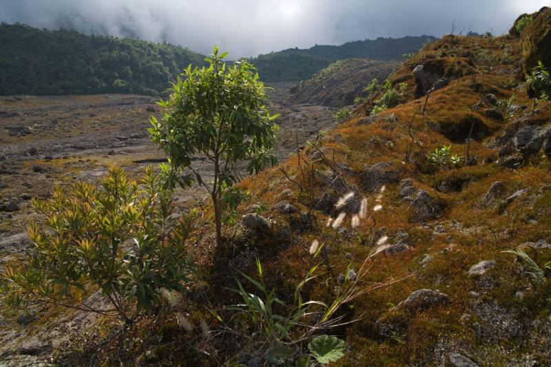
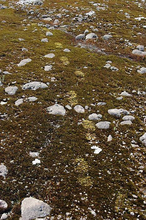

After reaching the plateau our guide left us after 7 hours. Hereby it is remarkable how the flora changes into the heath mode. Along the new lava stream, we reached the point where the actual mounting of the cone began.
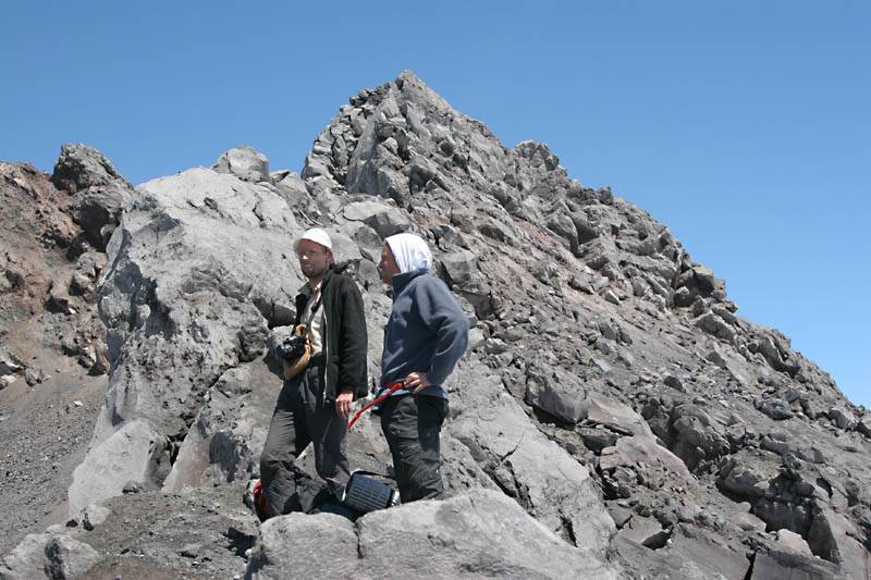
In the entire volcanic area it is not possible to provide yourself with drinking water. In this case we have to carry seven litres of water for three days. The additional weight becomes interesting if you ascend with the overloaded backpacks on the steep and difficult accessible flanks of this 1300 meter high symmetrical pyramid with a flank inclination of 38%.
 mr
mr
 mr
mr
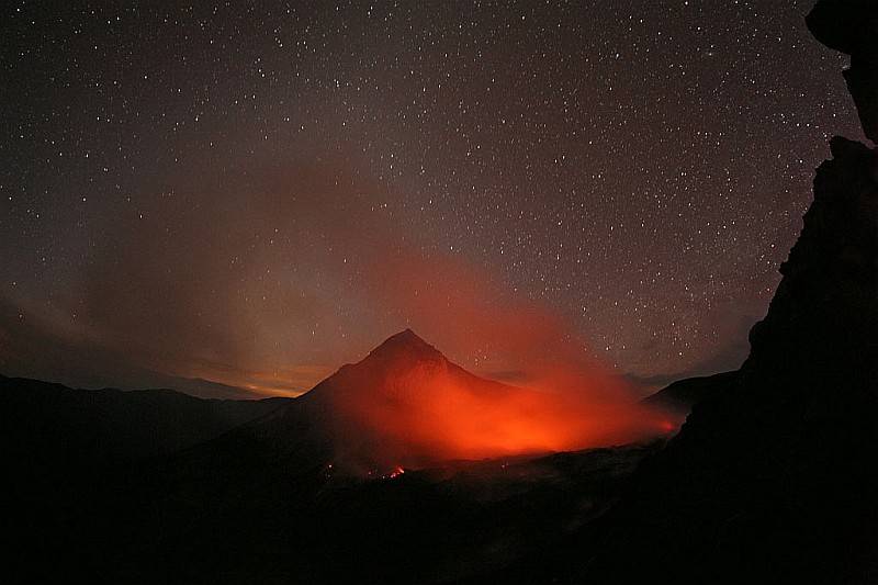
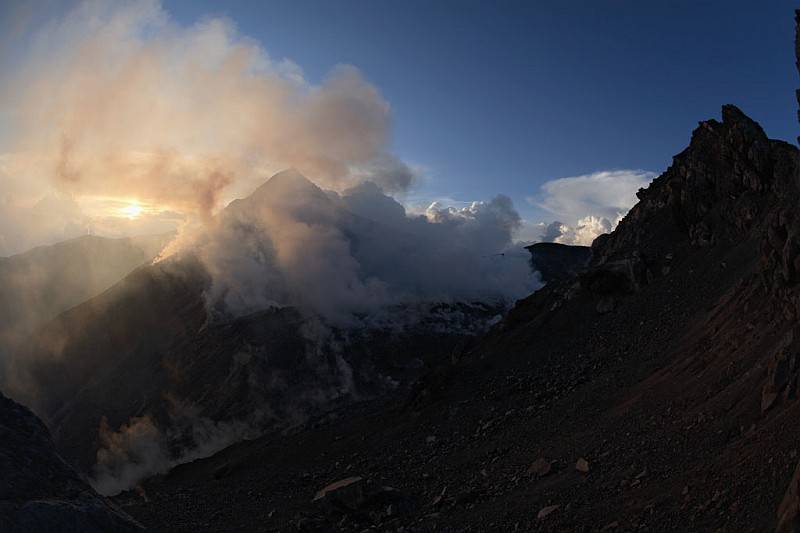
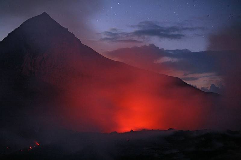
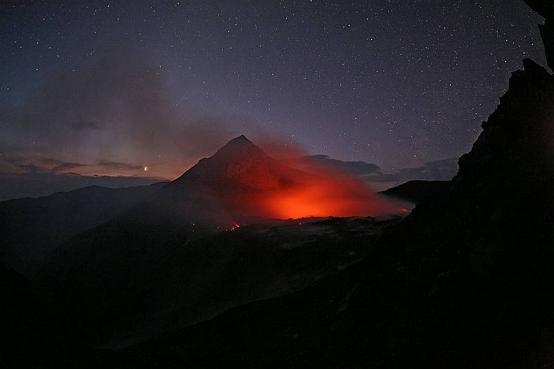
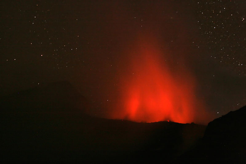
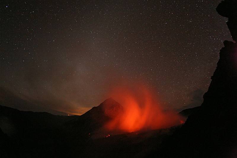
The next pictures show the remainder glowing of the main vent. Further brighter fumaroles can be recognized at the new dome. Ejections were not registered during the night. Only long exposure times let the light became visibly. For the human eye the whole scene appeared in a pale yellowish light. Martin originated from the eastern rim with his 14 mm fisheye objective still impressive zodiacal exposures to the west direction.
 tb
tb
 mr
mr
Unfortunately the fog appeared within minutes and blocked for the further night the view into the crater. But there is no reason for complaining, because normally it is really hard to see the volcano in a clear shape at all.
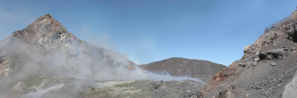
Day photographs of the blown up cone. The highest elevation was to be seen still toward the west. Probably this remainder could have still the height of 3500 m osl. On the eastern part our GPS could measured only a height of 3395 meters. An enormous volcanic showdown must took place in the summer 2005. Before this event the summit elevation was indicated officially by 3562 m osl.

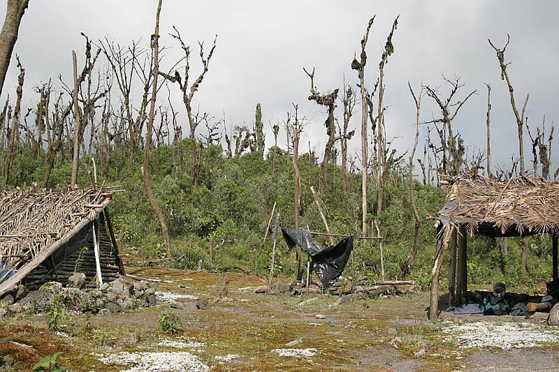
This shelter on 2000m was surrounded with died trees which felt to victim in reason of a powerful pyroklastic flow in June 1973 and only was stopped by the jungle itself. M. Hall anota: “Un gran lahar se extendió sobre la planicie suroriental de la caldera. Volumen del lahar es de 2.5 millones de metros cúbicos”. *Source (Instituto Geofisico / Quito)
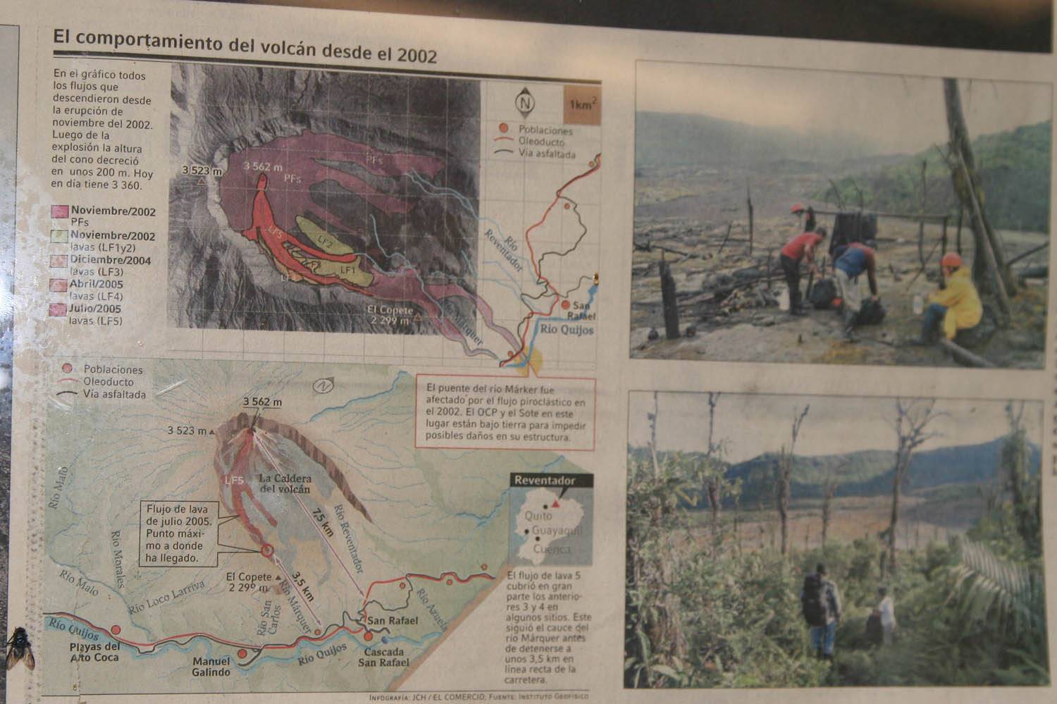

Photographed newspaper reports show the highlights of the eruption in summer 2005.
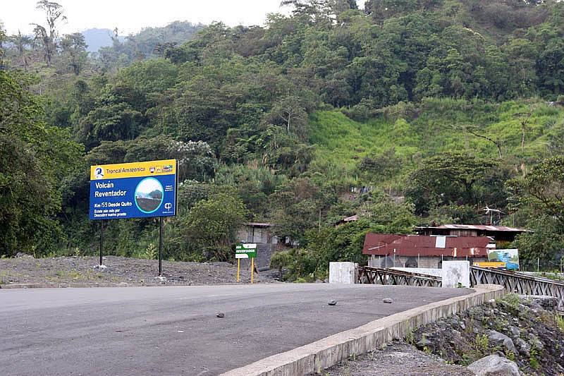

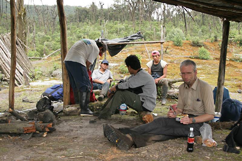
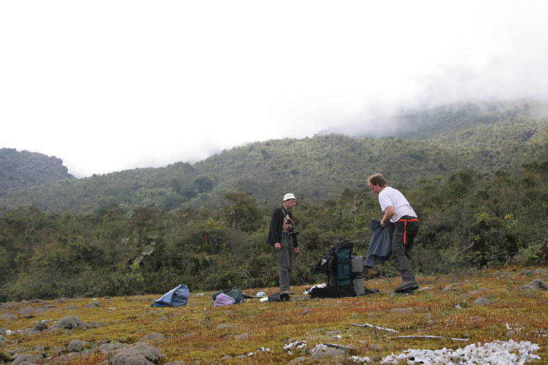
Beside the highway circuit road a small hostal was established near the entrance to the Reventador trail. A very according to the suppliment of water and food.
Here we met Bernardo Beate of the Instituto Geofisico in Quito. He led the field works at the volcano. The web site of the Instituto Geofisico in Quito, probably one of the best addresses for receiving informations due to the volcanic happenings in Ecuador. (in Spanish).
go to
|
Etna
Stromboli
Volcano world
From Etna to Stromboli
Planets & Space
©2006,
photos & text by Th. Boeckel (tb),
©
2006, photos Martin Rietze (mr) ,last modification 12.2.2006 This private, non-commercial web site do not use cookies ! |